What a 7 MW solar project revealed about terrain risk—and how to eliminate it before construction begins.
A Problem Most Teams Don’t See Coming
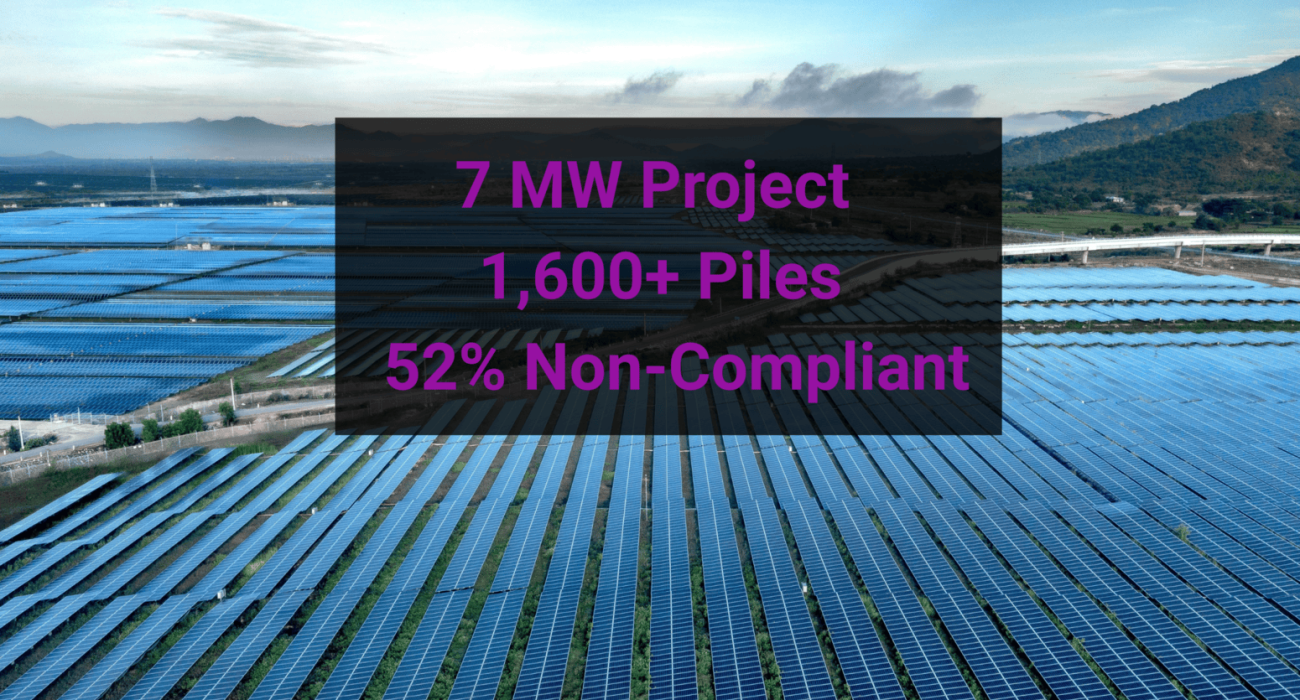
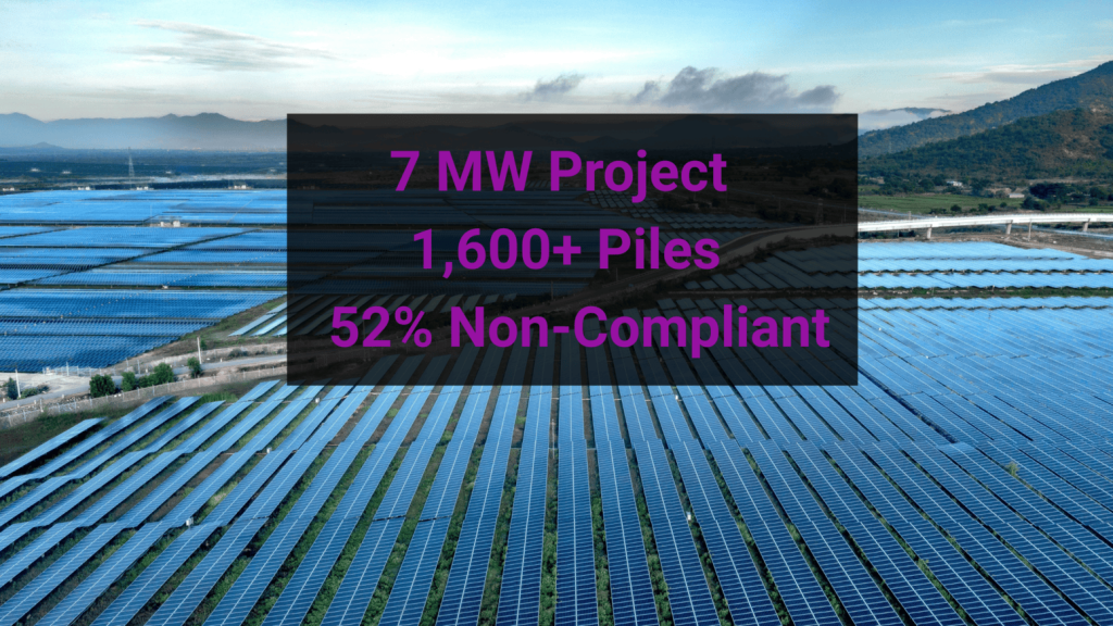
On a 7 MW utility-scale solar project, over 1,600 piles were analyzed across 112 tracker rows.
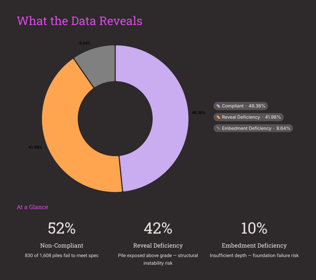
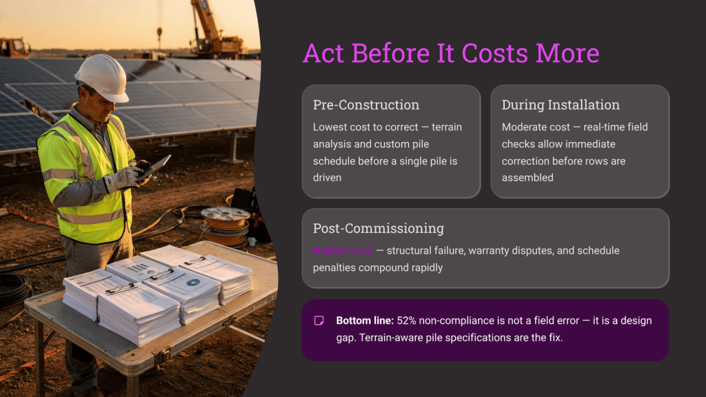
52% of them were non-compliant.
Not because of poor installation.
Not because of bad crews.
Because of terrain.
Before a single pile was driven, more than half of the foundation design would have failed to meet basic installation requirements.
What “Non-Compliant” Actually Means
When piles fail in solar construction, it usually comes down to two things:
- Reveal Deficiency
The above-ground height is too short, meaning the system can’t maintain proper geometry. - Embedment Deficiency
The pile doesn’t go deep enough into the ground to meet structural requirements.
On this project:
- 42% of piles had reveal issues
- 10% had embedment issues
These aren’t minor adjustments.
They are structural failures that directly impact system integrity, constructability, and long-term performance.
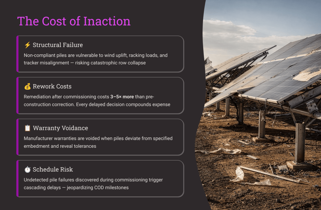
The Real Risk Isn’t Technical—It’s Financial
If these issues are discovered during construction, the impact is immediate:
- Idle pile-driving crews
- Halted installation sequences
- Rework and re-drilling
- Emergency procurement of longer steel
- Expedited shipping costs
- Schedule delays that ripple across the entire project
By the time the problem shows up in the field, it’s no longer a design issue.
It’s a budget problem.
And in many cases, a margin killer.
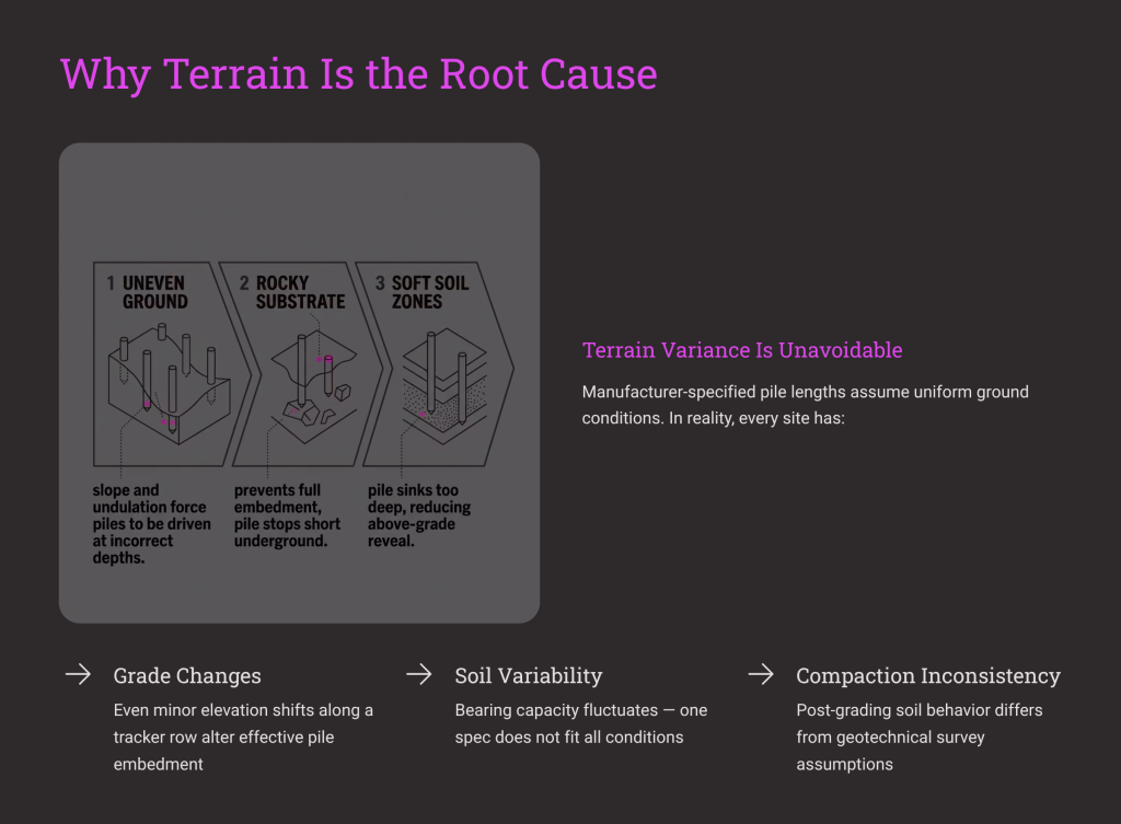
Why This Happens on So Many Projects
Because terrain is still treated as a secondary input.
Most projects rely on:
- Manufacturer-assigned pile lengths
- Simplified grading assumptions
- Incomplete or low-resolution terrain data
But real sites don’t behave like clean models.
They include:
- Rock outcroppings
- Micro-variations in slope
- Soil variability
- Vegetation and surface irregularities
These conditions don’t just affect layout.
The Shift: Solve Terrain Before You Mobilize
At Sunrobi, we approach terrain differently.
Instead of reacting to issues in the field, we resolve them digitally—before construction begins.
The process is straightforward:
1. Survey & Map
We deploy GPS rovers to create a high-fidelity Digital Terrain Model (DTM) of the site.
2. Elevate
We digitally adjust tracker table elevations across uneven terrain to resolve reveal deficiencies.
3. Extend
We assign optimized pile lengths to ensure proper embedment is achieved across all rows.
No guesswork.
No assumptions.
No field surprises.
From Terrain Data to Procurement Strategy
This is where most approaches fall short.
Terrain isn’t just a layout constraint.
It’s a procurement problem.
On this project, once terrain was properly modeled:
- Shorter piles were reduced where unnecessary
- Longer piles were assigned where required
- The entire pile distribution was rebalanced before mobilization
Instead of discovering mismatches during installation, the right materials arrived on day one.
The Result: Zero Rework, Full Compliance
After digital optimization:
- 100% of piles met reveal and embedment requirements
- Zero field rework was required
- Installation risk was eliminated before construction began
The outcome wasn’t just a smoother build.
It was a fundamentally different project risk profile.
All terrain-driven uncertainty was addressed upfront, where it’s cheapest and easiest to solve.
The Bigger Idea: Stop Solving Problems in the Field
Most solar projects are still designed around a reactive model:
Identify → Install → Discover issues → Fix
But the most efficient projects operate differently:
Identify → Model → Optimize → Build
The difference isn’t speed.
It’s certainty.
Stop Gambling on Terrain
Real terrain is unforgiving.
But it’s also predictable—if you model it correctly.
When you translate physical conditions into precise, buildable data, you don’t just improve construction.
You protect your schedule.
You protect your budget.
You protect your margins.
Bring Sunrobi your next site plan before you break ground.